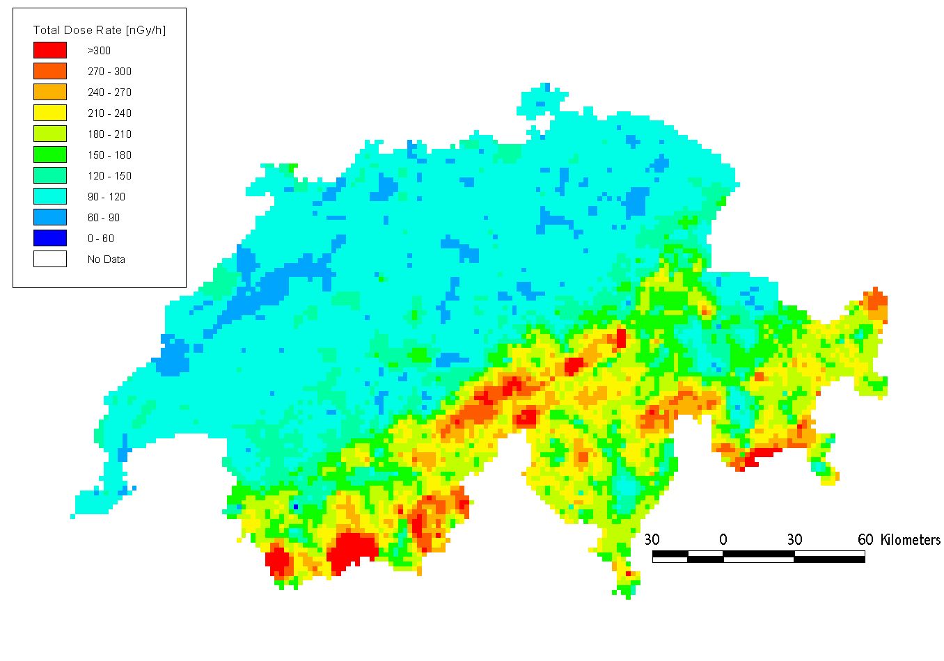
Helicopter-borne gamma ray spectrometry
is a rapid and sensitive method for mapping the radioactivity distribution
on the earths surface. Maps of terrestrial radiation, when converted to
dose rate distribution, are indispensable as a reference base for emergency
situations (nuclear accidents, lost radioactive sources, debris of reactor-powered
satellites). Quick mapping of the radioactivity distribution is thus indispensable
for decision making. A fully computerized measuring system, equipped with
a 16 liter NaI detector and GPS positioning for navigation, has been built,
calibrated and tested for deployment by the Swiss National Alarm Centre
(NAZ). Data processing and real-time visualization software has also been
developed. On behalf of the Swiss Federal Nuclear Safety Inspectorate (HSK)
we participate in international exercises and collaboration in harmonization
(EU project).
for the dose
rate
map of Switzerland
The measuring system is carried by a Super
Puma helicopter
!!! Dieses Dokument stammt aus dem ETH Web-Archiv und wird nicht mehr gepflegt !!!
!!! This document is stored in the ETH Web archive and is no longer maintained !!!